Benchmark ID: 136
| Owner: |
Environment Agency |
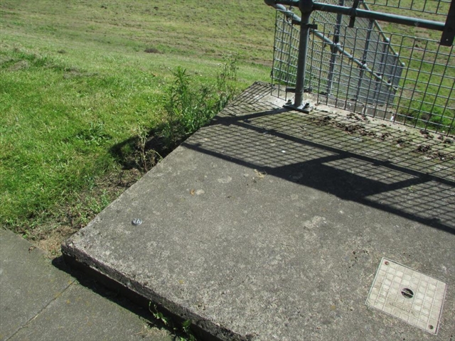
| Structure: |
Outfall
|
| Orientation: |
Horizontal
|
| Lat / Lng: |
 54.48672000,-1.49564000
Grid Ref:
NZ 3277 1027
54.48672000,-1.49564000
Grid Ref:
NZ 3277 1027
|
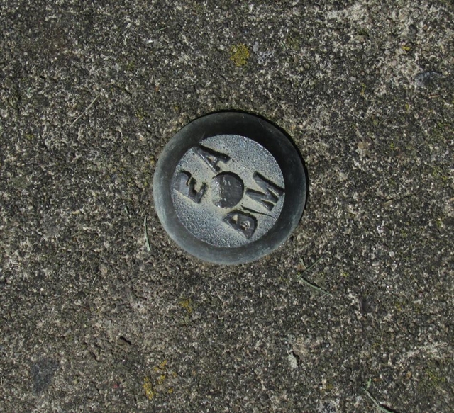
| Notes: |
EABM marker on outfall, by footpath on N bank of River Tees, Neasham.
The first of two markers, approx 180 metres apart.
Slight damage to the lettering on the benchmark.
Visited 20 Jun 2024 14:40
|
| EABM Name: |
|
| EABM Grade: |
|
| EABM Level: |
metres asl |
| EABM Active: |
|
| First Reported by: |
Ted Allwood |
| First reported: |
20-Jun-2024 |
| Latest sighting: |
20-Jun-2024 |
| Added to database: |
27-Oct-2024 |
© TED ALLWOOD
Photo taken 20 Jun 2024
© TED ALLWOOD
Photo taken 20 Jun 2024
If you wish to contact me with feedback and suggestions for the EA Benchmarks website, please use the form here instead.