Benchmark ID: 135
| Owner: |
Environment Agency |
| Structure: |
outfall
|
| Orientation: |
Horizontal
|
| Lat / Lng: |
 54.48589000,-1.49806000
Grid Ref:
NZ 3261 1017
54.48589000,-1.49806000
Grid Ref:
NZ 3261 1017
|
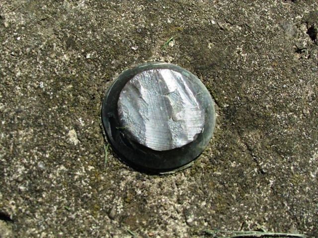
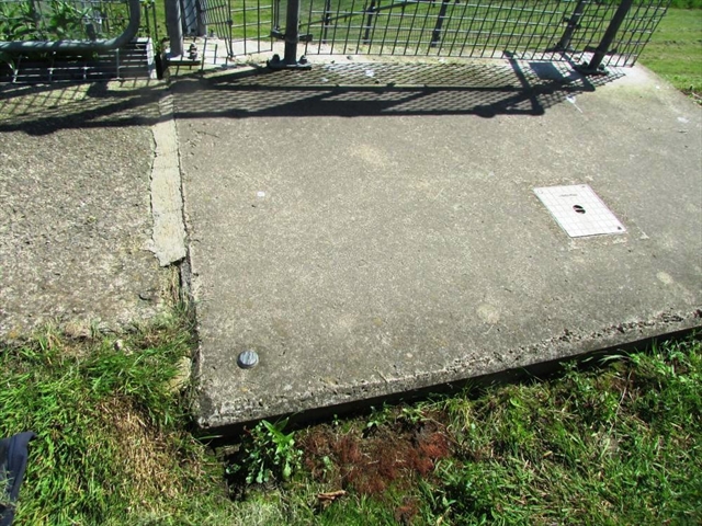
| Notes: |
EABM marker on outfall, by footpath on N bank of River Tees, Neasham
The second of two markers, approx 180 metres apart.
Significant damage to the benchmark - all of the lettering has been chiselled off.
Visited 20 Jun 2024 14:45
|
| EABM Name: |
E21210306 |
| EABM Grade: |
E2 |
| EABM Level: |
23.864metres asl |
| EABM Active: |
True |
| First Reported by: |
Ted Allwood |
| First reported: |
20-Jun-2024 |
| Latest sighting: |
20-Jun-2024 |
| Added to database: |
10-Oct-2024 |
© TED ALLWOOD
Photo taken 13 Oct 2024
© TED ALLWOOD
Photo taken 13 Oct 2024
If you wish to contact me with feedback and suggestions for the EA Benchmarks website, please use the form here instead.